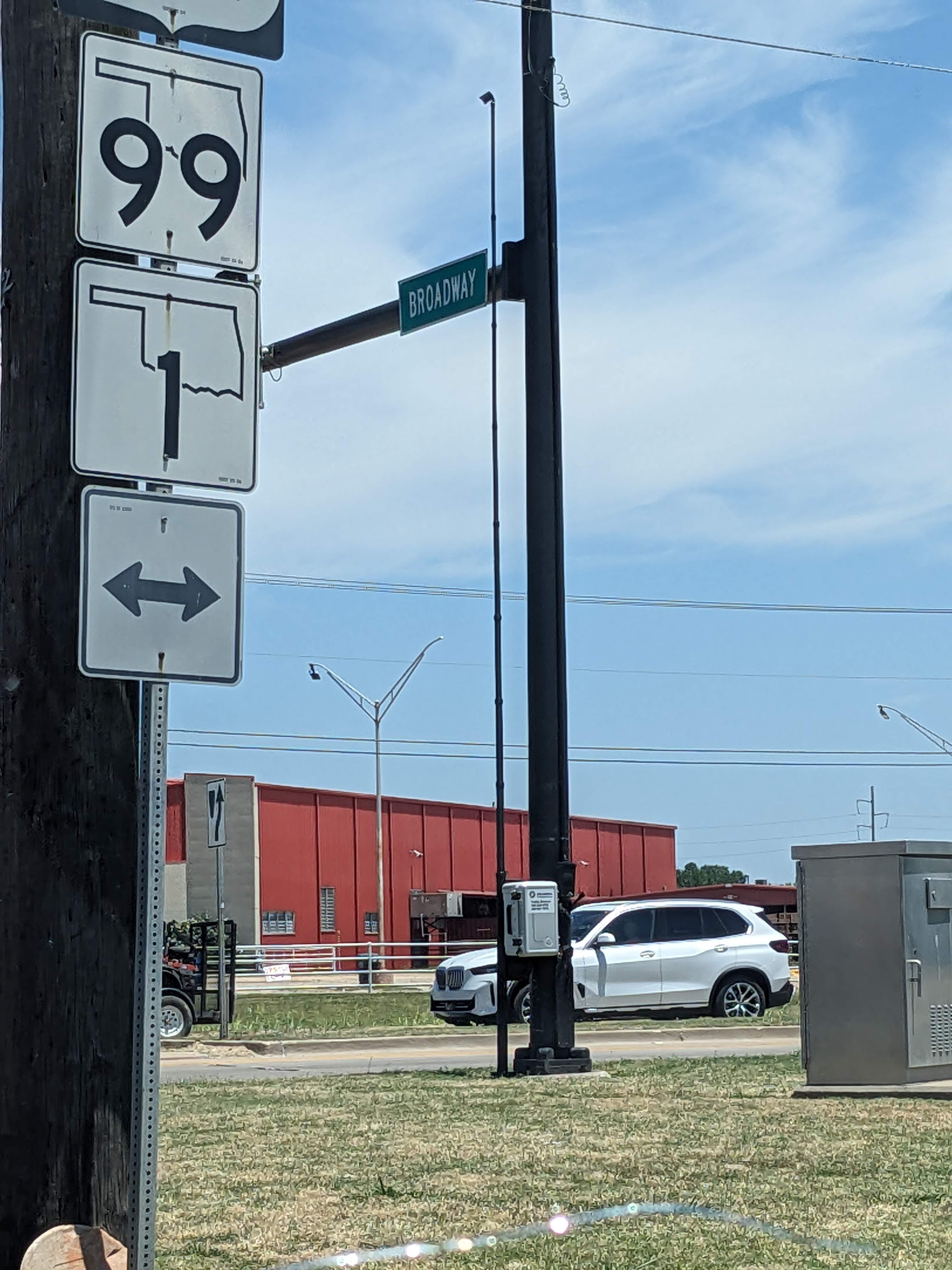
Broadway and Richardson Loop: Upcoming Near Miss Analysis
The Oklahoma Department of Transportation is actually looking at the intersection I flagged in a previous post!

A few days after I wrote my last post, about the safety hazards at the intersection of Broadway and Richardson Loop, the Active Transportation Coordinator at the Oklahoma Department of Transportation sent me an email. It began with the question: “If you had a camera that could look at the intersection at N. Broadway and NE Richardson Loop (by Pruett’s), where would you put it to see the most pedestrians trying to cross?”
That simple question kicked off a months-long process culminating in a traffic study that is being conducted this week! I am super excited that my post kicked off this chain of events, and I hope the result is actual changes to a dangerous intersection with the intention of improving safety for all road users, especially vulnerable road users.
I’ll start by thanking the parties involved, without calling out specific people at this juncture:
ODOT - Active Transportation and Traffic Engineering Divisions - and in the future, Division 3
Miovision
City of Ada
I hope we can all work together to make tangible improvements for the safety of the citizens of Ada and others who pass through this intersection.
Disclaimer: I’m writing and posting this without prior review by ODOT, Miovision, or the City of Ada.
The logistics
On Monday, June 24th, ODOT’s Traffic Engineering Division set up five Miovision Scout Plus cameras to observe five sections of this intersection: all four sides plus a common mid-block crossing point across from Pruett’s. For five days, the cameras will record footage of the intersection for use in a Near Miss analysis by Miovision. The field of view prioritizes the potential pedestrian crossing points but will capture vehicle use as well.
Once the footage is captured, Miovision will analyze a series of conflict types and give the intersection a score. The analysis takes into account vehicle counts and “interaction kinematics such as speeds, angles, and accelerations to assess the likelihood and potential severity of a collision.” For the purposes of this study, each possible conflict path will be evaluated for vehicle vs. pedestrian, vehicle vs. bicycle, and vehicle vs. vehicle.
Disclaimer: My information is based mostly on sitting in on initial meetings with Miovision, but I was not able to attend the actual planning meeting - so my understanding and accuracy of information on collection processes may be limited or incorrect in some aspects.
Once the footage is collected, it will be sent to Miovision for processing. The first step is an evaluation by a machine learning (ML) algorithm trained on a large dataset of intersection footage. The cameras actually have the capability to do this onboard, in real time, though for this study I’m unsure whether onboard processing will be used or raw footage collection with processing done after the fact.
The second step is for trained personnel at Miovision to construct a report using the ML-generated data. The report will include the total safety score, a table with a breakdown of scores for the different categories of interaction, and a selection of case studies from the footage gathered. It may also include recommendations for changes that could be made to improve the safety at the intersection. Miovision will have a couple of weeks to produce this report and deliver it to ODOT.
Last I heard, it was possible that a before and after study could be done. The part in progress now is the before. If ODOT decides they want to make improvements to the intersection, they can make changes and have Miovision run another analysis to demonstrate the improvement in safety score.
A recommendation for making changes
If they decide to take action, I believe there are a couple of routes that could be taken: temporary/incremental change or all-at-once/permanent change. I would advocate for temporary, incremental change.
Using temporary improvements (like changes to paint, installing flex posts, etc) to try out a new intersection design would require minimal cost and disruption to road users. Once the planned changes are implemented in a real-world trial, the feel of the intersection can be evaluated. If the changes feel bad, the trial implementation can be removed or modified easily in favor of a different approach.
If the changes feel good, the after phase of the study can be done to evaluate how much of a safety improvement was made - before spending a far larger sum on a permanent implementation (concrete work, traffic control positioning, curb modifications, pedestrian protective devices such as bollards, etc).
To be clear, the purpose of temporary changes is to prove a design as cheaply as possible in order to avoid setting an unexpectedly bad design in concrete. But also, using temporary changes to test a theory makes it more likely that something, any improvement, will at least be tried. As with this blog post, perfection is the enemy of done, and I’d hate to see a needed safety improvement take years to implement because we’re trying to jump straight to a permanent “best” design.
The purpose of temporary changes is not to allow a more easy reversion of changes after public pushback. Someone will always be upset. I would encourage the decision-makers to evaluate comments in a triaged manner, considering safety concerns first, followed by ease of use for vulnerable road users, followed by ease of use for vehicles. Ease of use for vehicles (or the more technical Level of Service) as a design goal is not working for this intersection, and should be the lowest priority going forward.
The why
I said in my previous article that “[T]he intersection cannot be designed solely to move vehicles in the most efficient manner. It must also be designed to protect its most vulnerable users.” I still believe VRUs are the most underserved users of this intersection, but I want to modify my statement above:
“The intersection cannot be designed solely to move vehicles in the most efficient manner. It must primarily be designed to move all users as safely as possible, and specifically protect its most vulnerable users.”
The difference is subtle but important. At the time of writing that article, I had only two recent datapoints for incidents at this intersection: a multi-vehicle fatality incident last year and the near-miss with a pedestrian the article was addressing. Since then, two more incidents have happened that I am aware of, both vehicle on vehicle.
I will dive into these incidents in a blog post next week. Suffice it to say that I am increasingly convinced that this intersection is dangerous, I fully expect this Near-Miss study and analysis to reflect that, and hope I can help identify some of the problem points and potential solutions from a unique point of view.
The beauty of Miovision’s Near-Miss analysis is that collisions don’t have to happen on camera to prove the intersection is unsafe. Their processing algorithm takes all the real factors that lead to a collision - speed, angle, acceleration, vehicle positions - and delivers a risk factor independent of the component of a collision that cannot be predicted: chance. The reason the study lasts for 5 days is so a sufficient amount of data can be collected showing how the intersection is used in an average week, which can be generalized as how the intersection is used in any week (therein lies a flaw in the execution of this particular study, but I’ll go over that in a future post as well).
In conclusion
I’ve probably forgotten a few things I wanted to say. Oh well - if I think of them I’ll include them in a future post. The gist: I’m excited this study is being done!
On a personal note, the reason this post is ramble-y and published after the study began is because I am writing it at 1am in a hospital room, because my wife gave birth to our fourth child on Monday! And I feel empowered to share this because the blog is still very small and I’m just one actual person who wants to see a better version of our city.
Here’s a picture, thank you, goodnight.